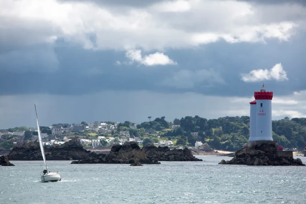
Sailing in North Brittany means choosing a magical destination for exploring the Channel coast, cruising with family or friends. This magnificent region is also a technical sailing area, with its powerful currents, impressive tidal range, well-hidden rocks and sometimes challenging weather. But there's no need to be discouraged: well-prepared, a sailboat cruise in Northern Brittany becomes an unforgettable adventure.
Here are our 5 tips for preparing your sailboat cruise from Saint-Quay-Portrieux, an ideal open-water port.
1. Plan your cruise according to the current
This is probably the golden rule of sailing in North Brittany. Here, most of the time, we sail "6 hours in one direction, 6 hours in the other". With currents that can reach 4 to 6 knots during spring tides, sailing against the current tires the crew, lengthens the trip and can overtax the engine. And as long as Loc Voile Armor has no Imoca foil boats available for charter, we recommend that youadapt your departure time to the tide and your sailing schedule.
Bonus tip: "wind against current, everything goes to hell", in other words, when wind and current are opposed, the sea becomes choppy and very uncomfortable. Keep this in mind for the comfort of your cruise.
2. Learn all about tides
When cruising in North Brittany, the words tides, tidal range and water height come up at every stop. The area can experience tidal ranges of up to 13 meters! Planning your cruises without calculating the tide means exposing yourself to unpleasant surprises.
Practical tip: use Maree.info (selecting the right reference port) and always check the draught of your charter yacht. And don't forget to check the veracity of the sounder data with a sounding line.
Anecdote: a customer ran aground in the Paimpol channel after a one-hour miscalculation... at coefficient 112, that's unforgivable.
3. Anticipate your arrival with plans B and C
Many ports on the Channel side of Brittany are subject to tides. In the event of a delay, a weir or lock may prevent entry to the port. You must therefore :
- Know which deep-water ports are accessible at all times,
- Plan an alternative port or anchorage in case of fatigue or unforeseen weather conditions,
- Plan to leave 1 to 2 hours before high tide from ports with weirs or locks to avoid the main current.
Good advice: beware of misconceptions: Tréguier and Lézardrieux are indeed in open water... but beware of the current in the rivers at mid-tide! Always aim for slack water when docking. We've already seen 5 knots displayed on the speedo once the yacht was moored in Lézardrieux harbor.
4. Always keep an eye on the map
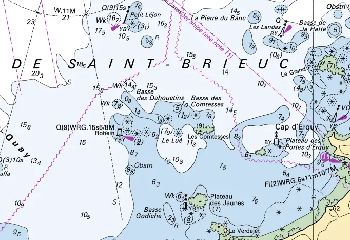
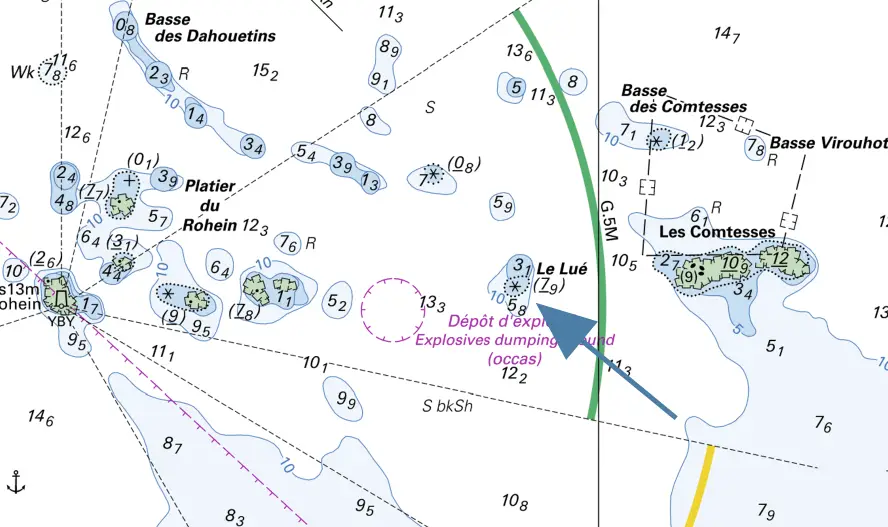
Between islets, rocky plateaus and invisible shoals, hidden just below the surface of the water, navigation with your eyes riveted to the map is a must. We know of an isolated rock head off Erquy that lies at -7.90 m at chart bottom.
Tip: zoom in on electronic charts, use a paper chart to keep an overview, and use up-to-date GPS plotters. Navigating by sight in the changing light of Northern Brittany is magical... as long as you're vigilant.
5. Stay flexible, even on a sailboat: adapt your program
Yes, sailing a sailboat means freedom. But not just any way. Here, you need to know:
- Modify your itinerary according to the weather and especially the wind direction,
- Shorten navigation if the wind shifts or the current reverses,
Yacht charters from Saint-Quay-Portrieux allow you to reach a wide variety of destinations, depending on conditions. It's a golden rule of sailing in North Brittany: flexibility prevails over pre-determined itineraries.
A cruise in North Brittany has to be earned... and enjoyed!
Whether you're a yachtsman, aspiring skipper or seasoned captain, North Brittany is a unique sailing school. Each day offers a different landscape, sculpted by the tides. Every stop is a reward.
As we say at Loc Voile Armor: "Who learns to sail in North Brittany, knows how to sail everywhere!" By the way: discover our article dedicated to apprentice sailors.
Bonus: 6 apps to plan your cruise in North Brittany
- Tide.info calculates tides and water levels in real time for selected ports
- Navily user reviews of anchorages and satellite view at low tide (ideal for beaching projects)
- Navionics electronic charts with GPS track and current drift (super handy)
- Anchor Alarm Anchor alarm for a good night's sleep
- Windy detailed, reliable marine weather
- Juzzy the mobile application for visualizing and playing with currents